29 August 2011 OS Explorer 181 Chiltern Hills North
Length: All day
This day was rather more walk than flowers, but still had its moments. The imminent onset of autumn was already obvious, with trees beginning to turn from green and fruits more prevalent than flowers.

Blackberries
We parked at the Wendover Woods car-park by Hengrove Wood SP898083 off the Aston Clinton-St Leonards road. We walked back to the road and went left (north) to the second footpath on the right, just after a house. This led across grassland to the corner of Bittams Wood (part of Dancers End Nature Reserve run by Berks Bucks & Oxon Wildlife Trust). (This route to Dancers End is the same, in reverse, as that taken in our 21 June blog.) The path follows the edge of the wood and then enters it, with the sound of roe deer barking immediately.

Beech yellowing in Bittams Wood
At cross-path we turned left along a wider grassy path with red bartsia Odontites vernus, eyebright Euphrasia nemorosa and lesser stitchwort Stellaria graminea. At the junction with another track we turned right and then immediately followed a smaller path on the left. This eventually leads to a gate into a grazed area of scrubland and then through a further gate into a grass ride, across which are a series of grazed meadows. Here we had used to see plentiful Chiltern gentians Gentianella germanica.

Chiltern gentian
Apart from large thyme Thymus pulegioides on the anthills, there was little notable at this time and only scattered Chiltern gentians. We then exited the reserve at the east end, where the ride leads to a gate and a sunken way down to the road at Ebb’s Pit.
At the lane we turned right and passed on the right-hand hedgebank fruits of dewberry Rubus caesius, fronds of Stagshorn sumach Rhus typhina and a pale pink variety of purple toadflax Linaria purpurea, the last two presumably seeded from a nearby garden. We immediately took a path on the left through a group of trees into a rough arable field with much black grass Alopecurus myosuroides, soft brome Bromus hordeaceus, common poppy Papaver rhoeas, field pansy Viola arvensis and small toadflax Chaenorhinum minus. Across another arable field and pasture the path led to a lane where we turned right, past lots of wood melick Melica uniflora on the banks and many young pheasants running everywhere. Just after Painsend Farm, where the lane turns sharp left, we turned right along a bridleway and took a left fork along a footpath up into Pavis Wood, past some large stands of gooseberry Rives uva-crispa. Our pleasure at leaving the muddy bridleway churned up by horses was muted by the fact that riders had also been using this footpath and turning that also into a quagmire. The wood is largely young tree growth over dog’s mercury Mercurialis perennis. There were few plants of note except a few elegant St John’s-wort Hypericum pulchrum.

Pavis Wood
At the top of the wood we crossed the Ridgeway and carried on the same footpath out of the wood and then across a very large field of flax now all in fruit and brown. We saw one plant of field pennycress Thlaspi arvense, a supposedly common plant which we actually see only rarely in this area. We eventually reached a track where we turned left. This track follows the line of Grim’s Ditch, although it is no longer evident along here. At Shire Lane we turned right, now following the Bucks-Herts county boundary. (We saw from the map afterwards that if we had digressed slightly left along Shire Lane
and then taken a footpath to the right we would have reached a section of Grim’s Ditch – in Herts - with surviving embankments.) Continuing SE the lane enters Drayton Wood and here there were ditches and embankments on each side, the banks topped by formerly laid old trees, marking well the ancient county boundary. At one point the way between the ditches was very wide – about 14 metres – making a very wide boundary track. Along here was yellow pimpernel Lysimachia nemorum. Where the wood was replaced by a field on the left-hand side the right-hand bank of the continuing wood-edge had spikes of violet helleborine Epipactis purpurata in seed but still obvious from their purple-tinted stems and leaves and their tendency to occur in clumps. At a footpath just before the village of Cholesbury we turned right and crossed the wood, but here the vegetation included hartstongue fern Phyllitis scolopendrium, wild angelica Angelica sylvestris, and tufted hairgrass Deschampsia cespitosa. It was dominated however by introduced species like pendulous sedge Carex pendula, snowberry Symphoricarpos albus, large bindweed Calystegia silvatica, and Japanese knotweed Fallopia japonica, the latter in flower, the white spikes standing both erect and hanging vertically down.
and then taken a footpath to the right we would have reached a section of Grim’s Ditch – in Herts - with surviving embankments.) Continuing SE the lane enters Drayton Wood and here there were ditches and embankments on each side, the banks topped by formerly laid old trees, marking well the ancient county boundary. At one point the way between the ditches was very wide – about 14 metres – making a very wide boundary track. Along here was yellow pimpernel Lysimachia nemorum. Where the wood was replaced by a field on the left-hand side the right-hand bank of the continuing wood-edge had spikes of violet helleborine Epipactis purpurata in seed but still obvious from their purple-tinted stems and leaves and their tendency to occur in clumps. At a footpath just before the village of Cholesbury we turned right and crossed the wood, but here the vegetation included hartstongue fern Phyllitis scolopendrium, wild angelica Angelica sylvestris, and tufted hairgrass Deschampsia cespitosa. It was dominated however by introduced species like pendulous sedge Carex pendula, snowberry Symphoricarpos albus, large bindweed Calystegia silvatica, and Japanese knotweed Fallopia japonica, the latter in flower, the white spikes standing both erect and hanging vertically down.

Path through Drayton Wood

Japanese knotweed
Near the far edge of the wood we turned left along another path, across another path and out of the wood into a horse pasture with abundant common ragwort Senecio jacobaea (strange how the British Horse Society promotes the destruction of this plant on other people’s land, while their members never seem bothered on their own).

Horse among ragwort
We then went along the edge of another small wood, where there was another garden escape, Canadian goldenrod Solidago canadensis, visited by hoverflies like Leucozona lucorum.

Leucozona lucorum on Canadian goldenrod
Across another field we entered the very deep ditch and steep embankments of Cholesbury Fort, a roughly circular Iron Age fortified settlement of around 0 AD, still surviving remarkably well around most of the perimeter except at the south end where a church and a few houses have obliterated it. An interpretation board stands on the gate immediately ahead. We turned left here, however, and walked around the embankment on its northern and eastern sides. Along the banks the main ground vegetation consisted of clumps of great wood-rush Luzula sylvatica, a plant that is very scarce in this region, but obviously thriving here.

Cholesbury Fort ditch with clumps of great wood-rush
Eventually the path leaves the embankment and leads to the back of the church, where there is a path into the road through Cholesbury. We passed stalls being set up on a wide green for an impending village fête (it was August Bank Holiday) and then took a road off right. Here we passed a former pond with water mint Mentha aquatica and reed sweet-grass Glyceria maxima, but now unfortunately mostly covered by a black plastic sheet weighted down by paving slabs in an attempt to destroy an invasion of New Zealand
At the bottom of this lane we took the bridleway to the right, again following the county boundary along the edge of Cholesbury Common, wooded mostly with oak Quercus robur and birch Betula pendula. This eventually leads into a more open section dominated by bracken, the beginning of Hawridge Common.

Hawridge Common
Already autumn fungi were beginning to appear, such as the blusher Amanita rubescens, the small pinkish scurfy twiglet Tubaria furfuracea and small oyster Pleurotus pulmonarius. At a road, we went briefly left and then right along a footpath into a wooded part of the common. Here there were some impressive old hawthorn trees Crataegus monogyna, the plant which of course gave the village of Hawridge

Old hawthorn, Hawridge Common

Haws
After seeing these, and some nearby red currant Ribes rubrum, we took a path across to the west side of the common (some small balsam Impatiens parviflora invading here) and the Hawridge-Cholesbury road. We walked back northwards along here until we were again at the outskirts of Cholesbury where the Full Moon pub (describing itself as a 17th century coaching inn), with an old windmill just visible behind, provided a resting-place for lunch with friendly service, with a choice of restaurant, bar or benches outside.


Cholesbury windmill
Leaving the Full Moon towards Cholesbury we turned left at the first road, from which one can see down the drive towards the windmill, which is now used as a private residence. At the second bend, where the road goes downhill, we took the path to the right across pasture and a taller grass field that had lots of burnet saxifrage Pimpinella saxifraga and a few fungi like Entoloma lucidum and fool’s funnel Clitocybe rivulosa. The un-harvested bean field that followed, with its blackened pods, had some parsley piert Aphanes arvensis. The path beyond is tightly confined between a barbed wire fence and garden fences, over which most householders were illegally throwing their garden waste, creating banks of nettles even more constricting the path. In the following horse pasture the path bends to the left and eventually reaches a small lane where we turned right and then left along a bridleway (Chiltern Way). At first this path is surfaced as it passes through an avenue of beeches Fagus sylvatica beside Dundridge Manor, originally an early medieval moated farmstead. The path is known as The Green and was part of an ancient road all the way from Missenden Abbey to St Albans , Dundridge being part of the Abbey lands.

Avenue
The current house is largely 17th century with 19th century facings. The moat had silted up but has recently been renewed to an impressive depth, although a modern faux draw-bridge has been added.

Mock drawbridge
One of the old beeches had large brackets of dryad’s saddle fungus Polyporus squamosus, which causes a white rot.

Dryad’s saddle
Underneath the trees was a lot of sanicle Sanicula europaea in fruit. After the manor the path becomes a wide grassy glade between hedges screening arable fields.
This track continues along the southern edge of Ashen Grove. Here, well protected by thickets of holly, grows Britain Britain

Britain’s tallest rowan

Rowan berries
The track then follows the northern edge of the adjoining Stonehill Wood. Near a house at the end of this wood, where the path joins a road, stands a large old hornbeam Carpinus betulus with “witches’ brooms”, bunches of short thick leafy twigs, caused by the ascomycete fungus Taphrina carpini, closely related to the one that commonly causes similar phenomena on birch trees, but this species specific to hornbeam.

Witches’ broom on hornbeam
Here we turned left along the road. On the steep bank on the right-hand side under an old oak was a specimen of the uncommon “lurid bolete” Boletus luridus, a cep-like fungus with red and yellow stem that gets its name from the fact that, when cut, the flesh inside rapidly becomes an intense blue. The cap was entirely eaten away with small bite-marks, presumably a small rodent (not like the patches eaten by slugs).

Lurid bolete
Also along this road was a neat pair of Panaeolus papilonaceus toadstools. Immediately after a road to the left signed to The Lee there is a footpath again off to the left along the edge of a cornfield and into Baldwin ’s Wood. (The Lee has a vicarious claim to some botanical fame in being the place of origin of the apple variety called “Bazeley”, a corruption of “best of The Lee”. Unfortunately we do not currently know of a specimen of this old variety extant at the village, although a few still survive elsewhere locally.)
In Baldwin ’s Wood was more yellow pimpernel surviving in what is now largely a larch plantation. There was also some rowan and plenty of ferns, not only the dark green fronds of broad buckler Dryopteris dilatata and clumps of male fern D. filix-mas, but also some clumps of the locally uncommon golden-scaled male fern D. affinis. We followed the path straight across the wood, keeping W to NW, with some difficulty, as there are more paths than indicated on the OS map. Towards the NW edge we took a path to the left following the edge until we emerged on a wide muddy track which we took to the right out of the wood over a wide ditch, which is a remnant of the same Grim’s Ditch along whose line we had briefly walked in the morning. It is wider and deeper than a normal wood-boundary ditch would be. We then went diagonally across a wheat-field, past an isolated house and into Hale Wood, which covers a steep chalk slope. We descended a little way to the bridleway (the Ridgeway path once more) that proceeds along its length, turned right and followed it, past more clumps of gooseberry, to a road where we took a short right before continuing the Ridgeway trail on the left through more woodland. Here there was some wood barley Hordelymus europaeus, sanicle, wood-sorrel Oxalis acetosella and woodruff Galium odoratum.
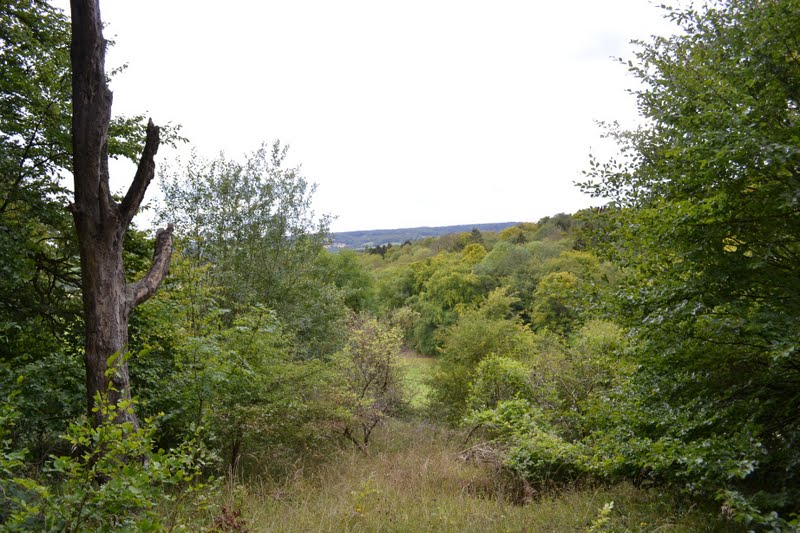
View from Hale Wood
The Ridgeway bends sharply down to join the Icknield Way, running along a deep valley below, but we carried on at the same level by a footpath which brought us to the Icknield Way higher up. Here we had to descend the steep bank to the Icknield Way
and up the bank opposite to enter Wendover Woods by a well-signed path that is not marked on the OS map. Here a dor beetle Geotrupes stercorarius flew into us, a large black beetle with a beautiful purple-blue sheen in the light. It is a type of burying beetle that stores dung for its underground larvae. There is a plentiful supply of this essential material from the well-used horse-trails around here. This path took us north, by the edge of Hengrove Wood to surfaced road where we turned right to return to the car-park where we started. Along here the road edge again has lots of violet helleborine spikes, almost all in seed although a couple still had recognisable flowers still out at the very tip.
and up the bank opposite to enter Wendover Woods by a well-signed path that is not marked on the OS map. Here a dor beetle Geotrupes stercorarius flew into us, a large black beetle with a beautiful purple-blue sheen in the light. It is a type of burying beetle that stores dung for its underground larvae. There is a plentiful supply of this essential material from the well-used horse-trails around here. This path took us north, by the edge of Hengrove Wood to surfaced road where we turned right to return to the car-park where we started. Along here the road edge again has lots of violet helleborine spikes, almost all in seed although a couple still had recognisable flowers still out at the very tip.

Violet helleborine fruiting-spikes
No comments:
Post a Comment